Japan is currently counted as having 14,125 islands.
For many years, the commonly cited figure was 6,852. In 2023, the Geospatial Information Authority of Japan published a new count based on more detailed digital mapping. Improved map data made it possible to identify smaller islands using consistent criteria.
The Japanese archipelago extends for more than 3,000 kilometers in a broad arc from northeast to southwest along the eastern edge of the Eurasian continent.
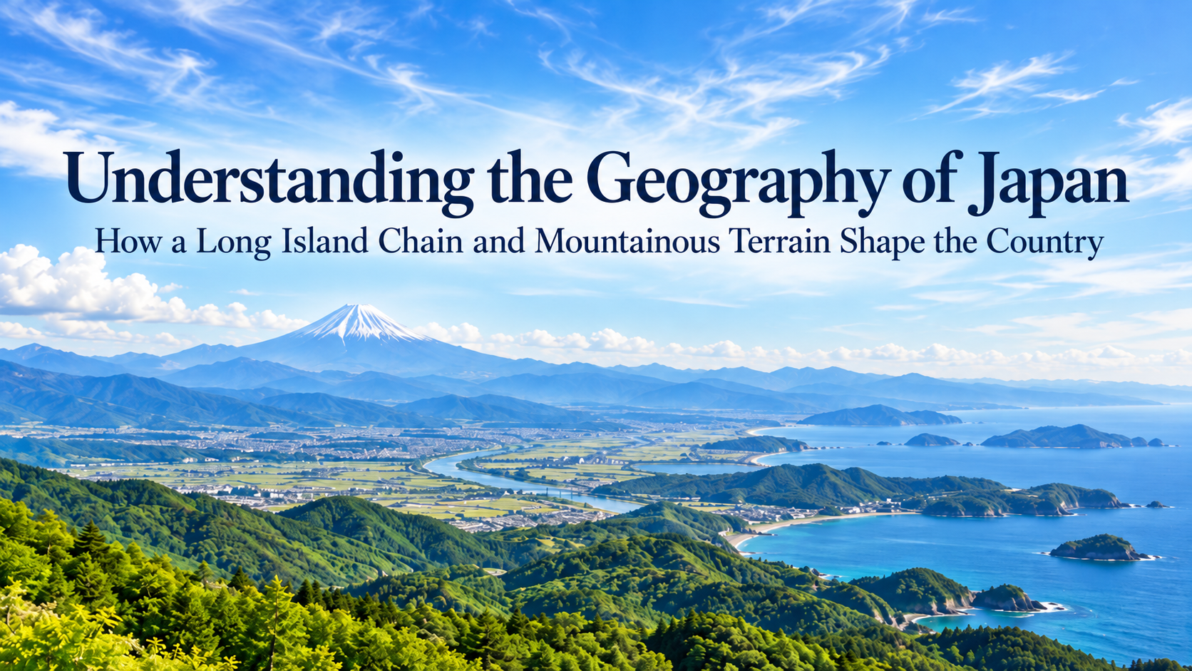
Mountainous terrain covers much of the country, while flatter land is concentrated mainly around rivers and coastal areas. The locations of cities and major transport routes also reflect this geography.
Heavy snowfall along the Sea of Japan coast and the presence of volcanoes and hot springs across the country are also closely connected with the position and physical structure of the archipelago.
- The Japanese Archipelago Stretches Along the Eastern Edge of Eurasia
- Climate Varies Greatly Along Japan’s Long North-South Axis
- Mountains Divide Much of Japan’s Landscape
- Many of Japan’s Largest Cities Developed on Plains
- Japan’s Rivers Are Often Short and Steep
- Japan Lies Along Active Subduction Zones
- Central Honshu Has a Complex Geological Structure
- The Sea Also Shapes Regional Climate and Daily Life
- Japan’s Geography Extends Far Beyond the Main Islands
- Geography Helps Explain Regional Differences
- Japan’s Geography at a Glance
- Geography Helps Explain What Travelers See
- Sources and Further Reading
The Japanese Archipelago Stretches Along the Eastern Edge of Eurasia
Japan is an island country located east of the Eurasian continent.
The Pacific Ocean lies to the east, while the Sea of Japan lies to the west. The Sea of Okhotsk is northeast of Hokkaido, and the East China Sea extends along Kyushu and the southwestern islands.
The four main islands are Hokkaido, Honshu, Shikoku, and Kyushu. Around them lie many other islands, including the Izu and Ogasawara islands, while the Nansei Islands extend southwest from Kyushu.
As of April 1, 2026, Japan’s land area is 377,974.87 square kilometers.
A map focused on Honshu can make Japan appear relatively compact. Once the outlying islands are included, the country extends across a much broader maritime area.
This geographic position has influenced Japan’s long history of contact across the sea as well as the natural environments that developed on individual islands.
Climate Varies Greatly Along Japan’s Long North-South Axis
Japan extends roughly from 20 to 45 degrees north latitude.
Hokkaido has a cool climate, while Okinawa and Amami have subtropical conditions. Much of Japan, including Tokyo and Kyoto, lies in the temperate zone between them.
Latitude is one factor, while mountains and surrounding seas also have a strong influence on local climate.
In winter, northwesterly seasonal winds blow from the Asian continent and pick up moisture as they cross the Sea of Japan. When this air reaches the mountains of Honshu, it produces heavy snowfall on the Sea of Japan side.
Areas on the Pacific side of the mountains often have more clear days during winter.
Places at similar latitudes can therefore have very different winter conditions depending on their position relative to the mountains.
The heavy-snow areas described in the Tohoku and Chubu articles can also be understood through the shape of the archipelago and the arrangement of its mountain ranges.
Mountains Divide Much of Japan’s Landscape
Mountains and hills cover about three-quarters of Japan.
Central Honshu contains the Japanese Alps, including the Hida Mountains, with peaks rising above 3,000 meters. Farther north, the Ou Mountains extend through Tohoku.
In Kyushu, volcanic areas such as Aso and Kirishima form another distinctive mountainous landscape.
The influence of these mountains can often be felt while traveling by rail.
On the Joetsu Shinkansen from Tokyo to Echigo-Yuzawa in Niigata Prefecture, the route crosses the mountains of central Honshu through long tunnels. Echigo-Yuzawa is closely associated with Yasunari Kawabata’s novel Snow Country and receives heavy snowfall in winter.
These mountains also influence the seasonal winds. Moist air arriving from the Sea of Japan releases large amounts of snow on the western side of the ranges, creating a pronounced difference in winter weather between the Sea of Japan and Pacific sides.
A train journey across these mountains provides a clear example of the relationship between Japan’s topography and climate.
Many of Japan’s Largest Cities Developed on Plains
The Kanto Plain is the largest plain in Japan.
The vast metropolitan area centered on Tokyo developed across this broad area. The contrast between Yamanote and Shitamachi discussed in the Kanto article is also related to the plateaus and lowlands around Tokyo.
In Chubu, the Nagoya metropolitan area spreads across the Nobi Plain. In Kansai, Osaka and its surrounding urban area developed largely across the Osaka Plain.
Many of these plains were formed by sediment carried downstream by rivers.
Flat land supported agriculture and urban growth, while low-lying areas near rivers have also required long-term flood control.
Looking at Japanese cities together with their surrounding landforms shows how closely urban development is tied to plains and river systems.
Japan’s Rivers Are Often Short and Steep
In many parts of Japan, mountains rise close to the coast, so rivers descend large differences in elevation over relatively short distances.
Many Japanese rivers therefore have steep gradients.
In their upper reaches, rivers cut through deep valleys. Where they emerge from the mountains, sediment carried downstream can form alluvial fans. Farther downstream, continued deposition contributes to plains and lowlands.
The Joganji River in Toyama Prefecture is a good example.
It flows from the mountains of the Northern Japanese Alps across the Toyama Plain and into Toyama Bay. Its large drop in elevation over a short distance clearly shows the steep gradients found in many Japanese rivers.
Alluvial fans have also shaped areas such as the Kofu Basin, where land formed by mountain rivers has long been used for agriculture.
Looking at mountains and rivers together shows how plains developed and why towns and farmland appeared where they did.
Japan Lies Along Active Subduction Zones
Around the Japanese archipelago, the Pacific Plate and the Philippine Sea Plate are subducting beneath plates on the Japanese side.
Areas where one tectonic plate sinks beneath another are known as subduction zones.
Movement along these boundaries places stress on the crust and contributes to earthquakes and volcanic activity. Over geological time, these processes have also played a role in mountain building.
Volcanoes such as Mount Fuji, Aso, and Sakurajima all lie within this geologically active setting.
Heat beneath the ground is also connected with Japan’s many hot springs. Onsen can be found from Hokkaido to Kyushu, reflecting the geological conditions beneath the archipelago.
Volcanic activity has also created calderas and crater lakes, giving different regions their own distinctive landscapes.
Japan’s mountains, volcanoes, and hot springs all reflect geological processes that continue beneath the surface today.
Central Honshu Has a Complex Geological Structure
Central Honshu contains some of the most important geological structures for understanding how the Japanese archipelago formed.
The Itoigawa-Shizuoka Tectonic Line runs from Niigata Prefecture to Shizuoka Prefecture and marks the western edge of the Fossa Magna.
The Fossa Magna is a major geological zone crossing central Honshu from north to south. Several geological structures that make up the Japanese archipelago meet in this area.
The Japanese Alps and Mount Fuji, discussed in the Chubu article, are also located in this central part of the country.
Honshu may appear continuous on the surface, while its underlying geology records a long history of tectonic movement and changing landforms.
The Sea Also Shapes Regional Climate and Daily Life
For much of Japan, the sea is never very far away.
The warm Kuroshio Current flows along the Pacific side, while the cold Oyashio Current influences waters off Hokkaido and Tohoku.
Differences in currents and sea temperatures affect marine ecosystems and fishing grounds. The waters off Sanriku, for example, are known for their productive fisheries.
The Sea of Japan also has a strong influence on regional climate.
In winter, seasonal winds pick up moisture over the sea before reaching the mountains, producing heavy snowfall along the Sea of Japan side.
In the Seto Inland Sea, numerous islands lie between Honshu and Shikoku. Maritime transport has connected communities there for centuries, and today bridges and ferry routes continue to link both sides of the sea.
Japan’s surrounding seas have shaped climate, transportation, and everyday life in coastal regions.
Japan’s Geography Extends Far Beyond the Main Islands
The figure of 14,125 islands includes everything from small islands close to Honshu to remote islands far out at sea.
The Ogasawara Islands, which are part of Tokyo, lie about 1,000 kilometers south of the city center. The Nansei Islands extend southwest from Kyushu toward Taiwan.
Including these islands shows how widely Japan’s territory is distributed across the surrounding seas.
Japan’s territorial waters and Exclusive Economic Zone, or EEZ, cover a maritime area far larger than its land area.
The islands also play an important role in fishing and maritime transport.
They have shaped distinctive natural environments as well. In the Ogasawara and Nansei islands, long periods of geographic isolation allowed unique species to evolve.
The high level of endemism discussed in the World Natural Heritage article is closely connected with the location and geological history of these islands.
Geography Helps Explain Regional Differences
Many of Japan’s regional characteristics are closely connected with the underlying geography.
Hokkaido has broad plains as well as volcanic landscapes. In Tohoku, the mountains running through the center of the region influence winter weather.
The Kanto Plain supported the growth of a vast metropolitan area. In Chubu, the Japanese Alps divide the region, with basins and heavy-snow areas around them.
Farther west, the Seto Inland Sea is dotted with islands between Honshu and Shikoku. In Kyushu, volcanic activity is connected with hot springs and some forms of agriculture.
Placing these regional features on a map of Japan shows how the arrangement of mountains and seas contributes to the differences between regions.
Japan’s Geography at a Glance
| Geographic Feature | Main Examples | What It Helps Explain |
|---|---|---|
| Long northeast-southwest archipelago | From Hokkaido to the Nansei Islands | Differences in climate and vegetation from north to south |
| Extensive mountain ranges | Japanese Alps, Ou Mountains | Basins, mountain passes, and regional climate differences |
| Plains and rivers | Kanto Plain, Nobi Plain | The development of cities and agricultural land |
| Steep rivers | Joganji River and others | The formation of alluvial fans and plains |
| Active tectonic setting | Mount Fuji, Aso, Sakurajima | Volcanic landscapes and hot springs |
| Sea of Japan and Pacific Ocean | Both sides of the archipelago | Differences in winter weather and coastal environments |
| Numerous islands | Ogasawara Islands, Nansei Islands | Distinctive island ecosystems and regional cultures |
Japan is commonly divided into regions such as Hokkaido, Tohoku, and Kanto. Because regional boundaries can vary depending on the purpose, their names and definitions are covered separately in Regional Divisions of Japan.
Differences between the Sea of Japan and Pacific sides, along with north-south variations in temperature, are explored in more detail in Climate of Japan.
Geography Helps Explain What Travelers See
The Kanto Plain helps explain the growth of the enormous urban area around Tokyo.
Traveling across the mountains on the Joetsu Shinkansen toward Echigo-Yuzawa shows how sharply winter conditions can change between the Pacific and Sea of Japan sides.
In Kyushu, hot spring towns lie close to volcanic areas. Around the Seto Inland Sea, islands remain connected by ferry routes and bridges.
These regional characteristics are closely related to the shape of the Japanese archipelago and the arrangement of its mountains. The surrounding seas have also influenced climate and transportation.
Following the mountains and rivers on a map while traveling can add context to the scenery outside the train window and to the location of towns along the route.
Understanding Japan’s geography helps explain how the landscapes and ways of life seen today developed in each region.
Sources and Further Reading
- Geospatial Information Authority of Japan, Land Area of Japan
- Geospatial Information Authority of Japan, Number of Islands in Japan
- Statistics Bureau of Japan, Statistical Handbook of Japan
- Ministry of Foreign Affairs of Japan, information on Japanese territory
- Ministry of Land, Infrastructure, Transport and Tourism, information on the land and rivers of Japan
- Geological Survey of Japan, AIST, information on plate tectonics and the geology of Japan
- Japan Meteorological Agency, information on the climate of Japan and heavy snowfall
- Japan National Tourism Organization, information on Echigo-Yuzawa
- Japan Coast Guard, information on Japan’s territorial waters and Exclusive Economic Zone