Traveling through Hokkaido reveals a remarkable variety of landscapes: expansive farmland, long stretches of road, snow-covered cities, volcanoes and lakes, wetlands, and drift ice along the Sea of Okhotsk. While Hokkaido is home to major cities such as Sapporo, once you leave the urban areas, mountains, forests, pastureland, and coastlines unfold on a much larger scale.
These landscapes are closely connected to Hokkaido’s size, northern climate, volcanic activity, and the seas that surround it. Hokkaido also has a long history shaped by the Ainu people, whose culture can still be seen today in place names and regional traditions.
Learning a little about this background before visiting Hokkaido can help you understand why the scenery, food, and cityscapes you encounter look and feel the way they do.
- A Vast Region Covering About 22% of Japan’s Land Area
- Hokkaido’s Climate Varies Greatly by Region
- Volcanoes, Lakes, and Wetlands Shape the Landscape
- Wide Open Land and a Cool Climate Have Shaped Hokkaido’s Food Culture
- Ainu Culture Is Essential to Understanding Hokkaido
- Hokkaido’s History Can Still Be Seen in Its Cityscapes
- Regional Differences Are Part of Hokkaido’s Appeal
- Understanding Hokkaido Changes the Meaning of Its Scenery
A Vast Region Covering About 22% of Japan’s Land Area
Hokkaido lies in the northern part of the Japanese archipelago and is the largest of Japan’s prefectures by area. It covers about 83,400 square kilometers, accounting for roughly 22% of Japan’s total land area.
You can appreciate this scale when traveling across Hokkaido. Well-known destinations such as Sapporo, Otaru, Hakodate, Asahikawa, Furano, Obihiro, Kushiro, and Shiretoko are spread across different parts of the island, and traveling between them can take considerable time.
When planning a trip, it helps to think of Hokkaido in broad regional divisions such as Southern Hokkaido, Central Hokkaido, Northern Hokkaido, and Eastern Hokkaido. This makes it easier to estimate travel times and decide how many days to spend in each area.
Hokkaido has extensive mountain ranges as well as plains, basins, and plateaus. The broad fields and pastureland of areas such as Tokachi, together with roads that seem to stretch toward the horizon, are also products of this spacious landscape.
Hokkaido’s Climate Varies Greatly by Region
Many people associate Hokkaido with cold weather and heavy snow, but the climate varies considerably across the island.
Hokkaido can broadly be divided into the Sea of Japan side, the Sea of Okhotsk side, the eastern Pacific side, and the western Pacific side. Ocean currents, seasonal winds, and mountain ranges all affect local conditions, so snowfall in winter and temperatures in summer differ from one area to another.
The Sea of Japan side, including Sapporo, receives large amounts of snow in winter. Parts of eastern Hokkaido on the Pacific side have many clear winter days, while drift ice reaches the coast along the Sea of Okhotsk.
This regional variation explains why the scenery—and even the clothing you may need—can differ depending on where you travel, even during the same season.
Spring arrives at different times across the island. In summer, mountains and wetlands turn deep green. Autumn brings colorful foliage, while winter transforms the landscape with snow and drift ice. In Hokkaido, the changing seasons have a dramatic effect on the scenery itself.
Volcanoes, Lakes, and Wetlands Shape the Landscape
Volcanic activity is another important part of Hokkaido’s natural environment.
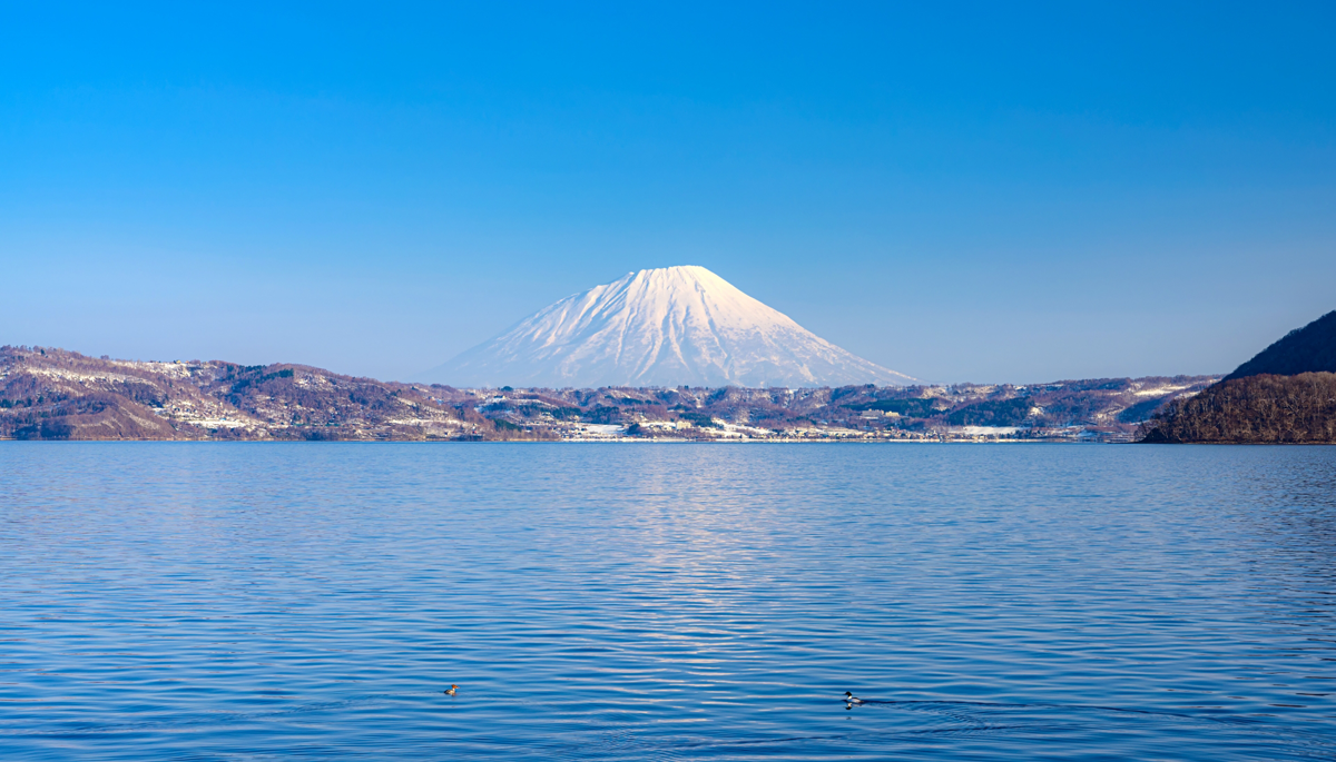
Areas such as Daisetsuzan, Akan-Mashu, and Shikotsu-Toya are characterized by volcanic landforms, with lakes and hot springs found throughout the surrounding regions. Many of Hokkaido’s most recognizable landscapes, including mountains, caldera lakes, and onsen areas, are closely tied to volcanic activity over long periods of time.
Eastern Hokkaido is home to Kushiro Shitsugen, known as Japan’s largest wetland. Farther northeast lies the Shiretoko Peninsula, while the coast along the Sea of Okhotsk is known for drift ice during the winter months.
When visiting Hokkaido’s natural areas, understanding how the land was formed can add another layer of meaning to the scenery.
The shapes of the lakes, the abundance of hot springs, the vast wetlands, and the arrival of drift ice in winter all have their own geological and climatic backgrounds.
Wide Open Land and a Cool Climate Have Shaped Hokkaido’s Food Culture
Travelers in Hokkaido often encounter dishes made with dairy products, potatoes, wheat, corn, onions, and seafood.
These foods are closely connected to Hokkaido’s natural conditions.
Large areas of farmland support crop cultivation and dairy farming. Hokkaido is one of Japan’s leading producers of agricultural and livestock products, including wheat, potatoes, sugar beets, onions, and milk.
Because Hokkaido is surrounded by the Sea of Japan, the Pacific Ocean, and the Sea of Okhotsk, seafood also varies from region to region. Hakodate is known for squid, eastern Hokkaido for salmon and salmon roe, and the Sea of Okhotsk coast for scallops. Local marine environments help shape these regional specialties.
When eating at markets or restaurants, thinking about the connection between local food, climate, and industry can give you a deeper understanding of Hokkaido’s food culture.
In some areas, farmland and pastureland themselves have become part of Hokkaido’s iconic scenery. Food and landscape often grow from the same regional characteristics, which is another distinctive feature of Hokkaido.
Ainu Culture Is Essential to Understanding Hokkaido
The history and culture of the Ainu people are an important part of understanding Hokkaido.
The Ainu are an Indigenous people of the northern Japanese archipelago, particularly Hokkaido. They have developed a rich culture that includes the Ainu language, spiritual traditions, songs and dances, embroidery, woodcarving, and food culture.
Traveling through Hokkaido, you will encounter many place names that originate from the Ainu language. Many of Hokkaido’s municipality names have Ainu origins, although they are now commonly written with Japanese kanji characters.
A large number of these place names describe the shape of the land or particular natural features.
For example, “Shiretoko” is derived from the Ainu term sir-etoko, meaning “the projecting end of the land.” When you picture the Shiretoko Peninsula extending far into the Sea of Okhotsk, the connection between the name and the landscape becomes easier to see.
“Toya” also comes from the Ainu language. To-ya is said to mean “the shore of a lake,” and the word survives today in the name Lake Toya.
Knowing the origins of Ainu place names can turn names on a map into clues for understanding the landscape itself. Rivers, capes, lakes, mountains, and other natural features were often reflected in the words used to describe particular places.
In the town of Shiraoi, Upopoy, the National Ainu Museum and Park, serves as a national center for learning about and preserving Ainu history and culture. The National Ainu Museum introduces visitors to the Ainu language, spiritual culture, everyday life, history, and contemporary initiatives.
When traveling in Hokkaido, paying attention to place names as well as scenery can change the way you see the land.
Hokkaido’s History Can Still Be Seen in Its Cityscapes
Hokkaido has a long Ainu history, and from the Meiji period onward, the Japanese government began large-scale development and urban construction across the island.
In central Sapporo, the streets form a regular grid running east-west and north-south. This basic layout took shape in the early Meiji period, when the Kaitakushi, or Hokkaido Development Commission, developed Sapporo as an administrative center for the development of Hokkaido. Odori divided the city into northern and southern sections, while the Sosei River served as an east-west reference point. Different areas were assigned functions such as government offices, factories, residences, and commercial districts.
Kyoto is another Japanese city well known for its grid-like streets. Kyoto’s urban structure can be traced back to the ancient jōbō system of Heian-kyo. Sapporo’s grid, by contrast, developed in the context of Hokkaido’s modernization and the construction of a new administrative city during the Meiji period.
Although the two cities may look similar on a map, their street patterns were created in very different historical periods and circumstances. Visiting both Kyoto and Sapporo can reveal how similar urban forms may reflect very different chapters of Japanese history.
During the development of Hokkaido in the Meiji period, knowledge and technology from the United States were also actively introduced. The Kaitakushi invited the American agricultural scientist Horace Capron to serve as an adviser, and foreign specialists worked in fields including agriculture, surveying, road construction, and industry.
Places such as the Sapporo Clock Tower, Hokkaido University, and the Former Hokkaido Government Office Building still offer glimpses of the period when Hokkaido was undergoing rapid modernization.
Regional Differences Are Part of Hokkaido’s Appeal
Hokkaido is so large that important regional differences can be overlooked if the entire island is treated as a single destination. For travelers, it is useful to understand the broad divisions of Southern, Central, Northern, and Eastern Hokkaido.
| Region | Main Places | What Travelers May Notice |
|---|---|---|
| Southern Hokkaido | Hakodate, Matsumae, Onuma | A long history of interaction with Honshu, with castle-town and port-town culture and some of Hokkaido’s most historic streetscapes |
| Central Hokkaido | Sapporo, Otaru, Niseko, Lake Toya | Hokkaido’s largest urban area together with port towns, hot springs, and mountain regions, allowing travelers to combine city sightseeing with nature |
| Northern Hokkaido | Asahikawa, Furano, Biei, Wakkanai | Mountains, rolling hills, and broad agricultural landscapes that make the scale of Hokkaido especially noticeable |
| Eastern Hokkaido | Obihiro, Kushiro, Akan, Shiretoko, Abashiri | Wetlands, volcanoes, lakes, drift ice, and some of Hokkaido’s most distinctive natural environments, with opportunities to encounter wildlife |
Walking through Sapporo and exploring the wilderness of Shiretoko can create very different impressions, even though both experiences take place in Hokkaido. Hakodate reflects a long history of interaction with Honshu, while Tokachi connects vast agricultural landscapes with a distinctive food culture.
The part of Hokkaido you choose to visit can therefore shape the kind of Hokkaido you experience.
Cities, food, Ainu culture, hot springs, mountains, wetlands, snow, and drift ice all reveal different sides of the island. Following these regional differences makes it clear that Hokkaido cannot be fully understood through a single image.
Understanding Hokkaido Changes the Meaning of Its Scenery
Wide fields, snowy cities, volcanoes and hot springs, wetlands, drift ice, seafood, and Ainu-derived place names are all well-known features of Hokkaido.
When you connect them with the island’s size, climate, geography, surrounding seas, history, and culture, they begin to form a larger picture of the region.
The shape of the Shiretoko Peninsula becomes more meaningful when you know the origin of its name. A meal made with Hokkaido ingredients can feel more closely connected to the landscape after seeing the vast fields where crops are grown. The grid of Sapporo’s streets can reveal another layer of the city once you know how it developed during the Meiji period.
When you visit Hokkaido, take some time to notice the natural and historical background behind the famous sights. Understanding why a landscape looks the way it does can reveal a side of Hokkaido that photographs alone cannot fully convey.
Sources and Further Reading
- Hokkaido Government, Hokkaido Data Book
- Hokkaido Government, information on Ainu-derived place names
- Upopoy (National Ainu Museum and Park), About Ainu Culture
- Sapporo City, materials on the history and urban development of Sapporo
- Japan National Tourism Organization, Hokkaido
- HOKKAIDO LOVE! – Hokkaido Official Tourism Site