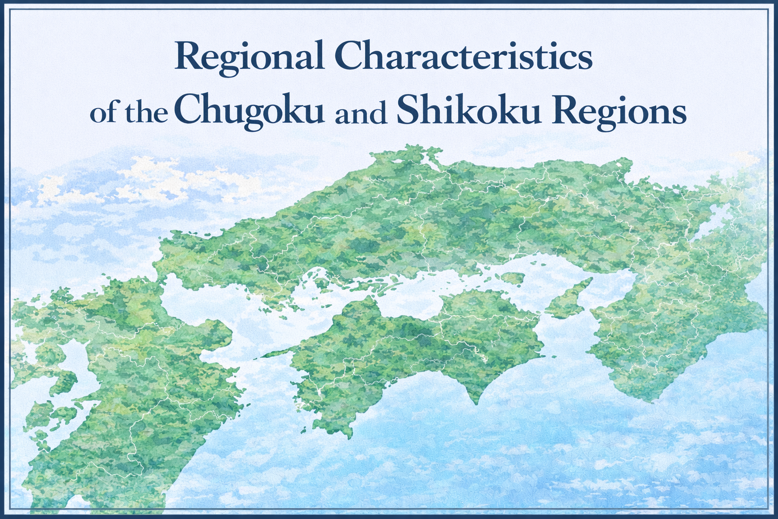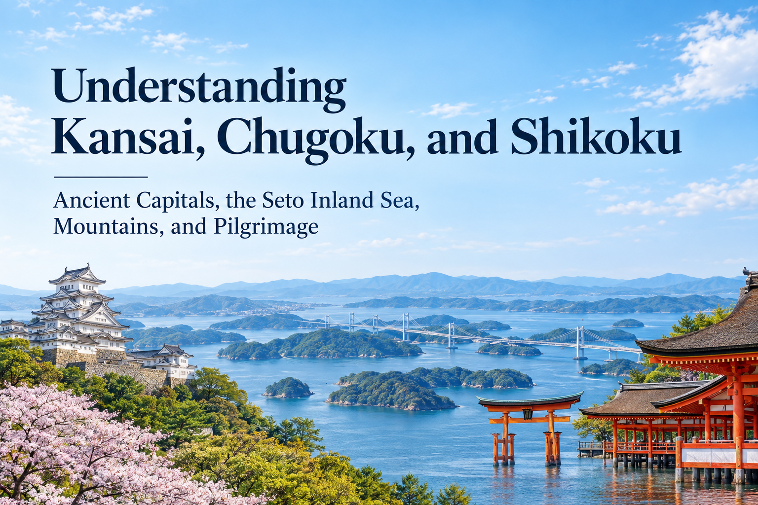
From the temples and shrines of Kyoto and Nara to the great city of Osaka, Himeji Castle, Itsukushima Shrine on Miyajima, the islands of the Seto Inland Sea, and the mountains and pilgrimage routes of Shikoku, the scenery and history change constantly as you travel west through Kansai, Chugoku, and Shikoku.
What connects this broad area is the relationship between mountains and sea.
In Kansai, political and cultural centers developed around Kyoto and Nara from ancient times, while the Kii Mountains rise to the south. In Chugoku, the Chugoku Mountains divide San’in and Sanyo, with the Seto Inland Sea lying to the south. Across the water, Shikoku is also crossed by high mountains, creating very different patterns of life along the coast and in the interior.
The Seto Inland Sea is more than the body of water between Honshu and Shikoku. For centuries, it has served as a route along which people, goods, and culture moved. Follow the sea west from Osaka Bay, and ports and islands continue through Hyogo, Okayama, Hiroshima, Yamaguchi, Kagawa, and Ehime.
In this article, the Kinki region refers to Mie, Shiga, Kyoto, Osaka, Hyogo, Nara, and Wakayama, together with the five prefectures of Chugoku and the four prefectures of Shikoku. In English-language travel information, “Kansai” does not always include Mie, which is sometimes grouped with Tokai instead.
- Kyoto and Nara Preserve the Layers of Japan’s Ancient Capitals
- A Water Route Connects Lake Biwa to Osaka Bay
- In the Kii Mountains, the Mountains Themselves Became Sacred
- The Seto Inland Sea Was a Maritime Route Linking Honshu and Shikoku
- Himeji Combines Castle-Town History with a Strategic Location
- The Chugoku Mountains Divide San’in and Sanyo
- On Miyajima, Mountain, Sea, and Shrine Form a Single Landscape
- In Shikoku, Central Mountains Divide the Seto Inland Sea Side from the Pacific Side
- The Shikoku Pilgrimage Turns the Entire Island into a Sacred Route
- Modern Routes Across the Seto Inland Sea Continue to Link the Regions
- Differences in Sea and Mountains Are Reflected in Food Culture
- Kansai, Chugoku, and Shikoku Each Have a Different Relationship with Mountains and Sea
- Seeing Kansai, Chugoku, and Shikoku Together Brings Western Japan’s History into Focus
- Sources and Further Reading
Kyoto and Nara Preserve the Layers of Japan’s Ancient Capitals
One of the defining features of Kansai is the concentration of places that served as political and cultural centers from ancient times.
Nara became the capital of Japan in the 8th century, and temples and shrines closely connected with Buddhism and the imperial court, including Todaiji, Kasuga Taisha, and Kofukuji, still remain today.
The capital later moved to Kyoto, which served as the residence of the emperor for more than a thousand years. Temples, shrines, gardens, traditional townhouses, crafts, and festivals now widely associated with Japanese culture are deeply connected to this long urban history.
Walking through Kyoto or Nara, the impression goes beyond simply seeing old buildings that have survived. The roads leading to temples and shrines, the surrounding mountains, the course of rivers, and the layout of old neighborhoods all reflect layers of history built up over centuries.
Osaka developed in a different way. Benefiting from river and maritime transport, it grew into a major commercial city where rice and other goods from across Japan gathered during the Edo period.
The coexistence of ancient capitals and a major commercial city within such a compact area is one of the keys to understanding Kansai.
A Water Route Connects Lake Biwa to Osaka Bay
Lake Biwa in Shiga Prefecture is the largest lake in Japan.
Water flowing out of the lake becomes the Seta River, is known as the Uji River after entering Kyoto Prefecture, and then joins the Katsura and Kizu rivers before becoming the Yodo River and flowing into Osaka Bay.
Shiga, Kyoto, and Osaka are separate prefectures on a map, but their waterways form a single connected system.
This network of rivers was also used for the movement of people and goods. Boat transport developed along the Yodo River between Kyoto and Osaka, carrying goods inland from Osaka Bay.
When you see rivers flowing through Kyoto or Osaka, tracing them upstream eventually leads back toward Lake Biwa and the surrounding mountains.
Kansai’s ancient capitals and commercial centers were linked not only by roads, but also by waterways.
In the Kii Mountains, the Mountains Themselves Became Sacred
Travel south from the urban areas of Kansai, and the scenery shifts into deep mountain country.
The Kii Mountains, stretching across Nara, Wakayama, and Mie prefectures, are home to long-established sacred sites including Yoshino and Omine, the Kumano Sanzan, and Koyasan.
These sacred places are linked by pilgrimage routes, and traditions of Shinto, Buddhism, and Shugendo have long interacted within this mountain environment. The Sacred Sites and Pilgrimage Routes in the Kii Mountain Range are inscribed as a UNESCO World Cultural Heritage Site, recognized as a cultural landscape in which mountains, forests, religious sites, and pilgrimage roads form an integrated whole.
Walking the Kumano Kodo reveals that the road itself carried meaning.
Pilgrims crossed mountains and rivers on their way to the Kumano Sanzan. The journey was not simply about arriving at a shrine. Walking the long route was itself part of the religious experience.
Kumano has also long been associated with the idea of spiritual renewal and rebirth. The difficult journey through the mountains came to symbolize leaving the past behind and beginning again.
Follow the religious culture of Kyoto and Nara southward, and in the Kii Mountains it becomes closely connected with forests, waterfalls, rocks, and mountain paths.
The Seto Inland Sea Was a Maritime Route Linking Honshu and Shikoku
West of Osaka Bay lies the Seto Inland Sea.
The sea is enclosed by Honshu, Shikoku, and Kyushu and dotted with many islands. Mountains often rise close to the coastline, creating the characteristic scenery of sea, islands, and coastal towns.
The calm appearance of the Seto Inland Sea is closely related to its geography.
Unlike the open Pacific, it is an inland sea surrounded by large landmasses. The Chugoku Mountains lie to the north and the Shikoku Mountains to the south, and the Seto Inland Sea region tends to have a relatively mild climate with less rainfall.
Calm water between the islands has become one of the defining images of Setouchi. At the same time, currents can be very strong in narrow straits, as seen in the whirlpools of the Naruto Strait.
The coexistence of tranquil island scenery and powerful tidal currents is one of the distinctive features of the Seto Inland Sea.
For centuries, this sea also served as a major transportation route across western Japan.
Traveling west from the Osaka area by sea connected Hyogo, Okayama, Hiroshima, and Yamaguchi before continuing toward Kyushu. Ports along the northern coast of Shikoku, including those in Kagawa and Ehime, were also linked to Honshu through maritime trade and travel.
Today, many of these places are connected by railways, expressways, and bridges, but ships were once essential.
Taking a ferry among the islands or walking through an old port town makes it easier to understand the Seto Inland Sea as a route across the water rather than a barrier between regions.
Himeji Combines Castle-Town History with a Strategic Location
Himeji in Hyogo Prefecture lies on the route from Kansai toward the Chugoku region.
It has long occupied an important position in transportation across western Japan, and during the Edo period a castle town developed around Himeji Castle.
The present castle is one of the finest surviving examples of early 17th-century Japanese castle architecture, with its main keep, gates, stone walls, and defensive enclosures arranged in a complex layout.
Himeji Castle is famous for the beauty of its white walls, but its location is equally important.
It stands along a major route leading west from Kyoto and Osaka toward the Sanyo region, with plains and the sea nearby. Looking at where the castle was built helps explain why Himeji became an important strategic point in western Japan.
The Chugoku Mountains Divide San’in and Sanyo
The Chugoku region consists of five prefectures: Tottori, Shimane, Okayama, Hiroshima, and Yamaguchi.
The Chugoku Mountains run east to west through the center of the region.
The northern side, facing the Sea of Japan, is known as San’in, while the southern side, facing the Seto Inland Sea, is called Sanyo. Even within the same region, the climate and scenery differ considerably.
San’in includes places such as the Tottori Sand Dunes, Mount Daisen, and the Sea of Japan coast, while Shimane is home to historically important areas such as Izumo and Iwami.
On the Sanyo side, cities such as Okayama, Kurashiki, and Hiroshima developed along the Seto Inland Sea and were connected by maritime routes to Shikoku.
Today, railways and roads make it easier to cross the mountains, but the fact that different regional cultures developed on the Sea of Japan and Seto Inland Sea sides remains one of the key ways to understand Chugoku.
On Miyajima, Mountain, Sea, and Shrine Form a Single Landscape
Itsukushima Shrine on Miyajima in Hiroshima Prefecture is one of the clearest examples of how the natural scenery of the Seto Inland Sea overlaps with Japanese religious culture.
The island of Itsukushima has long been regarded as sacred. The shrine complex that survives today is closely associated with Taira no Kiyomori in the late Heian period and was built facing the sea.
At high tide, the shrine buildings and great torii gate appear to float on the water, while the forested slopes of Mount Misen rise behind them.
The distinctive quality of the landscape comes from the way architecture, sea, and mountain are experienced together.
It is easy to focus only on the famous torii gate, but looking at the shrine together with the sea and the mountain makes it easier to understand why the island has been treated as a sacred place for so long.
Seen in this way, Miyajima becomes a landscape where the natural environment of the Seto Inland Sea and religious belief are closely connected.
In Shikoku, Central Mountains Divide the Seto Inland Sea Side from the Pacific Side
Shikoku consists of four prefectures: Tokushima, Kagawa, Ehime, and Kochi. It is the smallest of Japan’s four main islands.
The Shikoku Mountains run through the center of the island, and much of the flat land lies along the coast.
Kagawa and Ehime on the northern side face the Seto Inland Sea, looking across toward Okayama and Hiroshima on Honshu.
On the southern side, Kochi opens onto the Pacific, with a long coastline and mountains rising close behind it. In Tokushima, the Yoshino River cuts through the mountains, while places such as Iya are known for deep valleys.
Crossing Shikoku can involve long stretches of mountain road even over relatively short distances.
This geography shaped how different parts of the island were connected. The northern side developed strong maritime links with Honshu, while the Pacific side evolved within a landscape framed by both mountains and open ocean.
The Shikoku Pilgrimage Turns the Entire Island into a Sacred Route
One of Shikoku’s best-known cultural traditions is the pilgrimage to 88 temples associated with Kobo Daishi, or Kukai.
The temples are distributed around the island in a route that passes through Tokushima, Kochi, Ehime, and Kagawa. People still make the pilgrimage today on foot, by bicycle, by car, or using public transportation.
What makes the pilgrimage distinctive is not only the temples themselves, but also the time spent traveling between them.
Pilgrims follow coastal roads, pass through towns, and cross mountain routes on the way to the next temple. Over time, the journey becomes a physical way of experiencing the geography of Shikoku itself.
A key expression associated with the pilgrimage is Dōgyō Ninin, literally “two people traveling together.”
Even when a pilgrim walks alone, the idea is that Kobo Daishi is accompanying them. The phrase is often written on pilgrimage hats and clothing.
The Kumano Kodo in the Kii Mountains and the Shikoku Pilgrimage are both traditions in which walking itself carries spiritual meaning, but the ideas behind them are different.
In Kumano, the mountain journey has long been associated with rebirth and spiritual renewal. In Shikoku, the tradition emphasizes traveling around the island together with Kobo Daishi.
Understanding these different ideas changes the way each pilgrimage route is experienced.
Modern Routes Across the Seto Inland Sea Continue to Link the Regions
The ways people travel between Honshu and Shikoku changed dramatically in the modern era.
Today, Honshu and Shikoku are connected by major bridge systems including the Seto Ohashi, the Kobe-Awaji-Naruto route with the Akashi Kaikyo Bridge, and the Shimanami Kaido.
The Shimanami Kaido, connecting Onomichi in Hiroshima Prefecture with Imabari in Ehime Prefecture, crosses a chain of islands in the Seto Inland Sea.
A sea once crossed mainly by ship can now be viewed from bridges as travelers move above it.
The mode of transportation has changed, but the movement of people between Honshu and Shikoku continues.
The views of islands and water from these bridges also make it easy to see how the Seto Inland Sea forms a shared regional space rather than simply separating two shores.
Differences in Sea and Mountains Are Reflected in Food Culture
Across Kansai, Chugoku, and Shikoku, food culture also reflects geography and the history of transportation.
In Osaka and Kyoto, a cuisine based on kombu dashi developed using kelp transported from Hokkaido along western maritime routes. Follow the “Kombu Road” discussed in the Chubu article farther south, and the kelp carried from Hokkaido through the Sea of Japan eventually reaches the food culture of Kansai.
Another important ingredient widely used in Kansai is light-colored soy sauce, or usukuchi shoyu.
This style of soy sauce developed around Tatsuno in Hyogo Prefecture. Because its color is lighter, it can season soups and simmered dishes without darkening the ingredients as much, making it well suited to a style of cooking that emphasizes the appearance of the ingredients and the flavor of dashi.
In Kanto, dark-colored koikuchi shoyu became widely used, together with dashi often made from bonito flakes. The combinations of soy sauce and stock that developed in eastern and western Japan therefore differ in noticeable ways.
Kelp transported from Hokkaido, light soy sauce developed in Hyogo, and the cuisines of Kyoto and Osaka all became connected.
This shows that Kansai cuisine did not develop within one place alone.
Along the Seto Inland Sea, seafood is important, while the relatively warm and dry climate also supports citrus cultivation in many areas.
Kagawa is known for Sanuki udon, Kochi for dishes using bonito, and San’in for seafood from the Sea of Japan. As the relationship between mountain and sea changes, so does the food.
What is now called “local cuisine” often reflects both ingredients produced nearby and foods, techniques, and tastes carried along old sea routes and highways.
Tracing a dish back to the surrounding mountains, coast, and transportation routes reveals how long these regions have been connected.
Kansai, Chugoku, and Shikoku Each Have a Different Relationship with Mountains and Sea
The three regions can be broadly understood through the different ways nature and history come together.
| Region | Main Places | Key Features |
|---|---|---|
| Kansai / Kinki | Kyoto, Nara, Osaka, Kobe, Himeji, Lake Biwa, Kii Mountains | Ancient capitals and commercial cities, waterways from Lake Biwa to Osaka Bay, mountain worship in the Kii Mountains, and the eastern gateway to the Seto Inland Sea |
| Chugoku | Tottori, Matsue, Izumo, Okayama, Kurashiki, Hiroshima, Miyajima, Yamaguchi | The divide between San’in and Sanyo created by the Chugoku Mountains, the Sea of Japan and Seto Inland Sea, castle towns, port towns, and the sacred landscape of Miyajima |
| Shikoku | Tokushima, Takamatsu, Matsuyama, Kochi, Iya, Shimanami Kaido | The Shikoku Mountains, the Seto Inland Sea and Pacific coast, the 88-temple pilgrimage route, and maritime and bridge connections with Honshu |
The temples of Kyoto and the Pacific coast of Kochi, or the Sea of Japan in Tottori and the Seto Inland Sea in Kagawa, can feel completely different.
Mountains stand between them, while the sea has long carried people from place to place.
Seeing Kansai, Chugoku, and Shikoku Together Brings Western Japan’s History into Focus
Kyoto and Nara preserve the history of Japan’s ancient capitals, while the Kii Mountains to the south carry a long tradition of mountain worship.
Continue west from Osaka Bay, and the Seto Inland Sea links Himeji, Okayama, Hiroshima, Yamaguchi, and the ports and islands of Shikoku.
The Chugoku Mountains divide San’in from Sanyo, while the Shikoku Mountains create major differences within the island itself. People crossed those mountains along roads, and in the Kii Mountains and Shikoku, pilgrimage traditions also developed.
Food culture reveals the same kind of connection. Kelp from Hokkaido traveled south through the Sea of Japan and eventually reached Kansai, where it became part of the dashi culture of Kyoto and Osaka together with light soy sauce developed in Hyogo.
Viewed separately, Kansai, Chugoku, and Shikoku are often represented by famous destinations such as Kyoto, Hiroshima, and the Shikoku pilgrimage.
Spread out a map and add the mountain ranges, rivers, and Seto Inland Sea, however, and the old routes begin to connect: from ancient capitals to ports, from ports to islands, and across the water to Shikoku.
When traveling through this part of Japan, thinking about what lies beyond the mountains or where the sea in front of you leads can make the landscape feel like part of one long history rather than a collection of separate destinations.
Sources and Further Reading
- Japan National Tourism Organization, information on Kansai, Chugoku, and Shikoku
- Japan Meteorological Agency, information on the climate of Kinki, Chugoku, and Shikoku
- Ministry of the Environment, Setonaikai National Park
- UNESCO World Heritage Centre, Sacred Sites and Pilgrimage Routes in the Kii Mountain Range
- UNESCO World Heritage Centre, Himeji-jo
- UNESCO World Heritage Centre, Itsukushima Shinto Shrine
- Agency for Cultural Affairs, materials on historic pilgrimage routes and cultural heritage
- Shikoku tourism and pilgrimage organizations, information on the Shikoku 88 Temple Pilgrimage and Dōgyō Ninin
- Ministry of Agriculture, Forestry and Fisheries, materials on Kansai dashi culture and soy sauce
- Local government and tourism materials on Lake Biwa, the Yodo River, and historic inland-water transportation