Traveling through the Chubu region in central Japan, you will notice how dramatically the scenery changes depending on the direction you take.
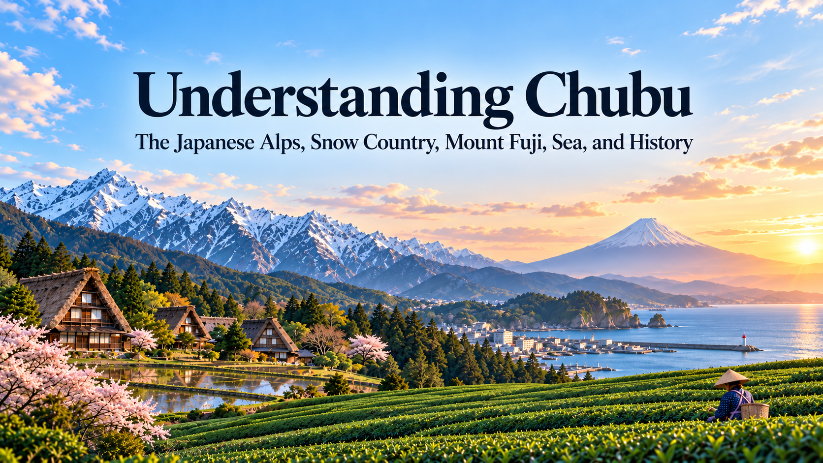
Along the Sea of Japan are the snowy regions of Hokuriku and Niigata. Farther inland, the high peaks of the Japanese Alps rise above basins and highlands. Continue toward the Pacific, and the landscape changes again to Mount Fuji, Shizuoka’s tea fields, Suruga Bay, the Nobi Plain, and the large urban area centered on Nagoya.
In this article, Chubu refers to nine prefectures: Niigata, Toyama, Ishikawa, Fukui, Yamanashi, Nagano, Gifu, Shizuoka, and Aichi.
The boundaries of “Chubu” are not always defined in exactly the same way. In travel and weather information, the region is often divided into areas such as Hokuriku, Koshinetsu, and Tokai. Even so, one of the clearest ways to understand Chubu is to look at the high mountain ranges that stand between the Sea of Japan and the Pacific.
These mountains influence where snow and rain fall, feed major rivers, and have long shaped the routes people could take. Over time, this geography helped create very different local cultures within the same region, from life in heavy-snow areas and highland agriculture to post towns, mountain worship, port cities, and industrial centers.
- The Japanese Alps Divide the Landscape of Chubu
- Chubu Is Also Where Eastern and Western Japan Meet
- The Sea of Japan Side Is One of the Snowiest Inhabited Regions in the World
- In Shirakawa-go and Gokayama, Snow Can Be Seen in the Shape of the Houses
- In Nagano and Yamanashi, Basins and Highlands Shape Daily Life
- Mount Fuji Is a Sacred and Artistic Mountain as Well as a Natural Landmark
- The Nakasendo Reveals How People Once Crossed the Mountains
- Kitamaebune Trade Connected Hokuriku with Distant Regions
- On the Pacific Side, the Landscape Changes to Tea Fields, Ports, Cities, and Industry
- Differences in Climate Are Reflected in Food
- Each of Chubu’s Nine Prefectures Has Its Own Character
- Traveling Through Chubu Reveals What It Means to Be at the Center of Japan
- Sources and Further Reading
The Japanese Alps Divide the Landscape of Chubu
Three major mountain ranges run north to south through central Chubu: the Hida Mountains, Kiso Mountains, and Akaishi Mountains. They are also known as the Northern, Central, and Southern Alps, and together are commonly referred to as the Japanese Alps.
Peaks over 3,000 meters, including Mount Yari, the Hotaka range, and Tateyama, rise across the region, with deep valleys and basins between them.
The Japanese Alps create some of Chubu’s most dramatic mountain scenery, while also acting as a climatic barrier between the Sea of Japan side and the Pacific side.
Many major rivers begin in these mountains or the surrounding highlands. Follow rivers such as the Shinano, Kiso, and Tenryu upstream, and you eventually reach the high mountains of central Japan.
Today, long tunnels, expressways, and high-speed railways make it possible to cross these mountain ranges relatively quickly. In the past, however, travel was largely confined to valleys and mountain passes. Looking at a map, it becomes easier to understand why cities and old post towns developed along narrow corridors between the mountains.
Chubu Is Also Where Eastern and Western Japan Meet
Chubu is a region where several of Japan’s east-west boundaries come together.
The Itoigawa-Shizuoka Tectonic Line runs from Itoigawa in Niigata Prefecture toward Shizuoka and forms the western edge of the Fossa Magna, a major geological zone created during the formation of the Japanese archipelago.
Around Itoigawa, visitors can learn how geological formations from eastern and western Japan meet in this part of the country.
Japan’s electricity system is also divided into eastern and western frequencies around Chubu. Eastern Japan mainly uses 50 Hz, while western Japan mainly uses 60 Hz, with the boundary running roughly from the Itoigawa area in Niigata toward the Fuji River area in Shizuoka.
This electrical divide has a completely different origin from the geological one. It dates back to the Meiji period, when Tokyo and Osaka introduced generators based on different standards. Even so, it is striking that both natural and technological boundaries appear in the same central part of Japan.
Differences between eastern and western Japan can also be found in food and language, although these do not follow a single clear line. Flavors, vocabulary, and customs change gradually as you cross mountains, valleys, and rivers.
Traveling through Chubu makes it clear that eastern and western Japan do not switch at one exact point. Instead, several boundaries overlap and blend across the region.
The Sea of Japan Side Is One of the Snowiest Inhabited Regions in the World
Niigata, Toyama, Ishikawa, and Fukui often experience rain and heavy snowfall in winter.
Cold seasonal winds from the Asian continent pick up moisture as they cross the Sea of Japan. When that air reaches the high mountains of central Japan, it rises and produces large amounts of snow, especially in mountainous and inland areas.
The contrast is easy to notice while traveling.
A town in Hokuriku or Niigata may be covered in snow while the Pacific side, beyond the mountains, is under clear blue skies.
Snow has shaped daily life for generations. The design of houses, road systems, snow removal, and agricultural practices all reflect the realities of living in regions with deep winter snowfall.
When spring arrives, melting snow flows into rivers and groundwater systems before reaching the plains. Rice cultivation in Niigata and Hokuriku, sake brewing, and industries that depend on abundant water are all connected to this seasonal cycle.
Winter snow, in other words, continues to influence life in the region long after it has melted.
In Shirakawa-go and Gokayama, Snow Can Be Seen in the Shape of the Houses
Shirakawa-go in Gifu Prefecture and Gokayama in Toyama Prefecture are known for traditional houses with steeply pitched thatched roofs called gassho-zukuri.
The Historic Villages of Shirakawa-go and Gokayama were inscribed as a UNESCO World Cultural Heritage Site in 1995. Their architecture reflects a way of life adapted to steep mountain terrain, heavy snowfall, and local economic conditions.
The sharply sloping roofs help snow slide off more easily. Inside the houses, large attic spaces were also used for sericulture, or silkworm cultivation.
The architecture therefore reflects both the climate of a heavy-snow region and the industries that supported local communities.
Today, the rows of triangular thatched roofs are one of Shirakawa-go’s most recognizable sights.
Knowing why the houses were built this way changes the way the village looks. The snow, surrounding mountains, and history of sericulture all become part of the landscape rather than separate details.
In Nagano and Yamanashi, Basins and Highlands Shape Daily Life
Several large basins lie around the Japanese Alps, including the Nagano, Matsumoto, Suwa, and Kofu basins.
Because these areas are inland and surrounded by high mountains, their climate differs from both the Sea of Japan coast and the Pacific coast.
Nagano also has many high-altitude areas with relatively cool summers. Highland vegetables and apples are widely cultivated there.
In the Kofu Basin of Yamanashi, vineyards and peach orchards spread across the landscape. The relatively dry basin climate, abundant sunshine, and differences between daytime and nighttime temperatures all support fruit cultivation, and the area is now also well known for wine production.
Traveling through Nagano or Yamanashi by train, the amount of open land changes as you pass through valleys and cross mountain ridges.
Unlike the broad, continuous plain of Kanto, inland Chubu is made up of separate basins divided by mountains. Towns and farmland developed within each of these spaces.
Mount Fuji Is a Sacred and Artistic Mountain as Well as a Natural Landmark
Mount Fuji, straddling Yamanashi and Shizuoka prefectures, is one of the most recognizable landscapes in Chubu.
At 3,776 meters, it is Japan’s highest mountain, and its symmetrical volcanic form has become one of the country’s best-known visual symbols.
The reason Mount Fuji was inscribed as a World Heritage Site reveals another side of the mountain.
In 2013, it was registered as a World Cultural Heritage Site under the title Fujisan, Sacred Place and Source of Artistic Inspiration. For centuries, people climbed the mountain as an act of worship or religious practice, while Sengen shrines and pilgrimage sites developed around its base.
Mount Fuji has also appeared repeatedly in painting and literature. In the 19th century, ukiyo-e artists such as Katsushika Hokusai and Utagawa Hiroshige helped spread images of the mountain far beyond Japan, influencing Western art as well.
The view changes depending on where you stand: Mount Fuji reflected in the Fuji Five Lakes, seen across the sea from Shizuoka, or rising above a shrine at its foot.
The mountain travelers photograph today is the same mountain that people have looked toward, prayed to, and depicted in art for centuries. That history gives Mount Fuji a meaning that goes far beyond simply being Japan’s highest peak.
The Nakasendo Reveals How People Once Crossed the Mountains
Because Chubu lies in the center of the Japanese archipelago, important routes connecting eastern and western Japan have passed through the region for centuries.
One of the best known was the Nakasendo, one of the five major highways of the Edo period.
The road connected Edo and Kyoto along an inland route through what are now Nagano and Gifu prefectures.
Former post towns such as Tsumago and Magome still preserve wooden streetscapes that make it easier to imagine travel in an age when people crossed mountain passes on foot.
Mountain travel was shaped by steep passes, snow, rivers, and changing weather. These natural conditions influenced where post towns developed and how far travelers could reasonably cover in a day.
Today, high-speed rail makes it possible to travel from Tokyo toward Nagoya and Kyoto in only a few hours. Walking parts of the old Nakasendo offers a very different view of how people once crossed central Japan.
Kitamaebune Trade Connected Hokuriku with Distant Regions
In Hokuriku, the Sea of Japan shaped history alongside the mountains and snow.
Kanazawa developed as the castle town of the powerful Kaga domain, and traces of that history remain in samurai districts, teahouse quarters, gardens, and traditional crafts. Fukui and Toyama also have histories as castle towns, while port communities developed along the Sea of Japan coast.
From the Edo period into the Meiji period, merchant ships known as Kitamaebune traveled between ports around Japan.
They carried rice, kelp, herring, and many other goods from Hokkaido, Tohoku, and the Sea of Japan coast toward the Seto Inland Sea and Osaka.
One especially important example was the movement of kelp from Hokkaido. This distribution network is sometimes referred to today as the “Kombu Road.”
In Toyama, kelp brought from Hokkaido was combined with fish from Toyama Bay to create kombu-jime, a local method of curing fish between sheets of kelp. In Tsuruga, Fukui Prefecture, techniques developed for shaving kelp into thin sheets known as oboro kombu.
The kelp continued south toward Kyoto and Osaka, where it became deeply connected with the development of dashi-based cuisine.
Kelp harvested in the waters around Hokkaido therefore traveled through ports along the Sea of Japan and took on different culinary roles in each place it reached.
The ships carried more than commodities. Cooking methods, processing techniques, and people also moved from port to port.
Following Hokkaido’s seafood culture southward reveals a direct connection with the food traditions of Hokuriku and, eventually, Kansai.
On the Pacific Side, the Landscape Changes to Tea Fields, Ports, Cities, and Industry
Travel south toward Shizuoka and Aichi, and the scenery changes again.
In Shizuoka, tea fields spread across hillsides and mountain slopes, while Suruga Bay and the Enshu coast open onto the Pacific.
One of the distinctive features of Shizuoka is how quickly the elevation changes between the highlands around Mount Fuji and the coast of Suruga Bay.
Farther west, the Nobi Plain opens up around Nagoya, one of Japan’s largest metropolitan areas.
Aichi developed into a major manufacturing center, particularly in industries such as automobiles. The area around the Port of Nagoya has become one of the major industrial and logistics zones in central Japan.
At the same time, the surrounding region also includes pottery towns such as Tokoname and historic places such as Inuyama.
Crossing Chubu from the Sea of Japan to the Pacific can therefore take you through snowy towns, 3,000-meter mountains, inland basins, tea fields, ports, major cities, and industrial districts.
Few regions in Japan show such dramatic changes within a relatively short distance.
Differences in Climate Are Reflected in Food
Food also changes significantly from one part of Chubu to another.
Niigata and Hokuriku are major rice-growing areas with many well-known sake-producing regions. The Sea of Japan coast is also associated with seafood such as crab, yellowtail, and firefly squid.
Inland Nagano is known for soba, highland vegetables, and apples, while Yamanashi is famous for grapes, peaches, and wine.
Continue to Shizuoka, and tea and seafood become more prominent. In Aichi, a distinctive local cuisine has developed around ingredients such as miso.
Hokuriku’s kelp culture is a particularly good reminder that local cuisine is not always based solely on ingredients produced locally. Kelp brought from Hokkaido by ship was combined with local seafood and processing methods until it became part of the region’s food culture.
Placing the foods you encounter while traveling on a map reveals the geography behind them: sea, mountains, elevation, snow, farmland, and the routes along which people and goods moved.
In Chubu, crossing a single mountain range can change both the landscape and what appears on the table.
Each of Chubu’s Nine Prefectures Has Its Own Character
Chubu is a large and diverse region that cannot be represented by a single landscape.
| Prefecture | Main Places | What Travelers May Notice |
| Niigata | Niigata, Echigo-Yuzawa, Sado, Joetsu | The Sea of Japan, heavy snow, rice and sake, mountains, and port history |
| Toyama | Toyama, Tateyama, Kurobe, Gokayama | The Tateyama mountain range, deep alpine landscapes, the Sea of Japan, snow, abundant water, and kelp culture |
| Ishikawa | Kanazawa, Kaga, Noto | Castle-town culture, crafts, Sea of Japan cuisine, Kaga traditions, and peninsula scenery |
| Fukui | Fukui, Eiheiji, Echizen, Wakasa, Tsuruga | Zen culture, the Sea of Japan, traditional crafts, kelp processing, and landscapes where mountains and sea lie close together |
| Yamanashi | Kofu, Fuji Five Lakes, Katsunuma | Mount Fuji, inland basins, grapes and peaches, wine, and mountain scenery |
| Nagano | Nagano, Matsumoto, Karuizawa, Hakuba, Kiso | The Japanese Alps, highlands, snow, hot springs, post towns, and mountain culture |
| Gifu | Gifu, Takayama, Shirakawa-go, Gujo | The mountains of Hida, gassho-zukuri villages, castle towns, the Nagara River, and traditional culture |
| Shizuoka | Shizuoka, Izu, Mount Fuji area, Hamamatsu | Mount Fuji, tea fields, the Pacific, Suruga Bay, and a relatively mild coastal climate |
| Aichi | Nagoya, Inuyama, Tokoname, Mikawa | A major urban region, castle towns, manufacturing, pottery, and the Nobi Plain |
The snowy scenery of Hokuriku, the highlands of Nagano, the orchards of Yamanashi, the tea fields of Shizuoka, and the urban landscape of Nagoya can feel so different that it is easy to forget they all belong to the same broader region.
One of the main reasons for these differences is the chain of mountains running through the center of Japan.
Traveling Through Chubu Reveals What It Means to Be at the Center of Japan
Chubu contains the Japanese Alps, heavy-snow regions, Mount Fuji, hot springs, gassho-zukuri villages, orchards, old post towns, castle towns, tea fields, ports, and industrial cities.
The mountains bring heavy snowfall to the Sea of Japan side, feed rivers, and create inland basins. People crossed them through valleys and mountain passes, while ships connected distant communities along the Sea of Japan.
Kelp from Hokkaido reached Hokuriku through Kitamaebune trade, while travelers crossed the Nakasendo between eastern and western Japan. Geological and electrical boundaries also run through the region from around Itoigawa toward Shizuoka.
Chubu is therefore both a place where eastern and western Japan are divided and a place where people, goods, and culture have crossed those divisions for centuries.
By high-speed train, it is possible to pass through much of Chubu between Tokyo and Kyoto in only a few hours. Travel inland or toward the Sea of Japan, however, and the region reveals how the great mountain systems at the center of the Japanese archipelago have shaped climate, food, architecture, transportation, and culture.
Sources and Further Reading
- Japan National Tourism Organization, information on Chubu, Hokuriku-Shinetsu, and Tokai
- Japan Meteorological Agency, information on the climates of Hokuriku, Koshin, and Tokai
- Ministry of the Environment, information on Chubusangaku National Park
- UNESCO World Heritage Centre, Historic Villages of Shirakawa-go and Gokayama
- UNESCO World Heritage Centre, Fujisan, Sacred Place and Source of Artistic Inspiration
- Itoigawa UNESCO Global Geopark, information on the Fossa Magna and Itoigawa-Shizuoka Tectonic Line
- Ministry of Agriculture, Forestry and Fisheries, materials on kombu and regional food culture
- Local government materials on Tsuruga’s kombu-processing culture
- Agency for Cultural Affairs and local government materials on the Nakasendo
- Cultural materials on Kitamaebune maritime trade