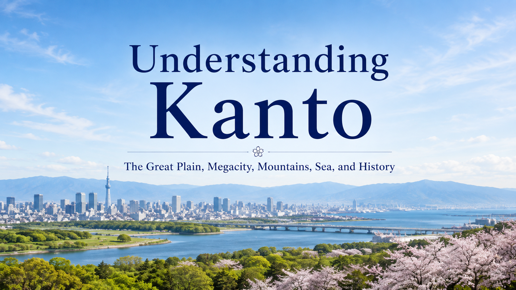
Many travelers begin their journey through Japan in Tokyo. Yet the Kanto region extends far beyond the city itself. Within the same region, you can encounter Tokyo’s high-rise skyline and vast railway network, the port of Yokohama, the temples of Kamakura, the mountains and shrines of Nikko, the hot springs of Hakone, and the coast of the Boso Peninsula.
Kanto consists of Tokyo and six prefectures: Kanagawa, Chiba, Saitama, Ibaraki, Tochigi, and Gunma. At its center lies the Kanto Plain, the largest plain in Japan. Mountains rise to the north and west, while the Pacific Ocean borders the region to the east and south.
The development of one of the world’s largest metropolitan areas is closely connected to this broad plain, its rivers and coastline, and the transportation networks that have linked Edo and Tokyo with the surrounding region for centuries.
Look beyond central Tokyo, and another side of Kanto begins to appear.
- The Kanto Plain Laid the Foundation for a Vast Metropolitan Area
- Roads from Edo Still Shape Kanto Today
- Mountains and Snow Are Closer to Tokyo Than They Seem
- Volcanoes and Hot Springs Are Also Part of the Kanto Experience
- In Nikko, Nature and Tokugawa History Overlap
- Kamakura Preserves a Warrior History Older Than Tokyo
- Tokyo Bay and the Pacific Shaped Kanto’s Cities and Culture
- Tokyo Also Includes Subtropical Islands Far to the South
- Farmland Near the Megacity Also Matters
- Gunma’s Silk Industry and the “Silk Road” Reveal Japan’s Modernization
- Each of Kanto’s Seven Prefectures Has Its Own Character
- Understanding Kanto Also Changes the Way You See Tokyo
- Sources and Further Reading
The Kanto Plain Laid the Foundation for a Vast Metropolitan Area
One of the defining features of Kanto is the enormous plain that spreads across the center of the region.
Lowlands and plateaus extend through Tokyo, Saitama, Chiba, Ibaraki, Tochigi, and Gunma, crossed by major rivers such as the Tone, Arakawa, and Tama.
While walking through Tokyo, you may not immediately notice that the city is part of a vast plain. From a high vantage point, however, the urban area seems to continue almost without interruption toward the horizon.
This relatively flat land provided room for residential districts, farmland, roads, railways, and industrial areas to expand. The many railway lines radiating outward from Tokyo also reflect the way cities developed continuously across the Kanto Plain.
The plain is not completely flat, however. Plateaus such as the Musashino and Shimosa plateaus create clear differences in elevation, and those differences can still be seen in modern streetscapes.
In Tokyo, the western side includes many areas of higher ground and sloping streets, while the eastern side contains lowlands shaped by rivers and canals. This contrast in terrain has influenced both the development of the city and the atmosphere of its neighborhoods.
The higher ground west of the Imperial Palace is associated with what is often called the Yamanote area. During the Edo period, many daimyo residences and samurai districts were located on these plateaus. In contrast, lower-lying areas to the east, including Nihonbashi, Asakusa, and Fukagawa, developed as merchant and commercial districts where waterways played an important role in moving people and goods.
Edo’s actual land use was more complex than a simple division between samurai in the west and merchants in the east. Even so, walking through the sloping streets of Yamanote and then through the river- and canal-rich neighborhoods traditionally associated with Shitamachi reveals how closely geography and urban history overlap.
Roads from Edo Still Shape Kanto Today
Transportation networks played an important role in the development of Kanto into the metropolitan region it is today.
During the Edo period, the Tokugawa shogunate developed five major highways connecting Edo with other parts of Japan: the Tokaido, Nakasendo, Koshu Kaido, Nikko Kaido, and Oshu Kaido. Nihonbashi served as their official starting point.
The area around Nihonbashi was also crossed by canals and waterways, allowing goods and people from across Japan to gather there and helping it grow into a major commercial center.
Even today, Nihonbashi is home to the marker indicating the starting point of Japan’s national road network.
Routes leading from Tokyo toward Nikko, toward Yokohama and Odawara along the old Tokaido, and northwest along the Nakasendo still overlap in part with travel routes used today.
Modern trains and expressways allow travelers to pass through these areas quickly, but following old highways and former post towns offers another way to understand how places around Kanto were connected to Edo.
Rivers were equally important transportation routes.
Kawagoe in Saitama Prefecture was connected to Edo through boat traffic on the Shingashi River. Rice, grains, textiles, tea, sweet potatoes, timber, and other goods produced in and around Kawagoe were transported by boat to Edo, while clothing, household goods, and other products traveled in the opposite direction.
Today, Kawagoe is often called “Little Edo” because of its historic kurazukuri warehouse district. Its prosperity, however, was also supported by a water-transport network that connected the town with Edo.
The rivers of the Kanto Plain were not simply natural features. Before roads and railways became dominant, they also served as transportation corridors linking towns and cities. Looking beyond Kawagoe’s historic streets to the Shingashi River makes it easier to see how Edo was connected with the surrounding region.
Mountains and Snow Are Closer to Tokyo Than They Seem
Kanto is strongly associated with urban life, yet mountains extend across its northern and western edges.
Nikko in Tochigi, the mountain areas of Gunma, Chichibu in Saitama, Okutama in western Tokyo, and Hakone in Kanagawa all offer landscapes very different from central Tokyo, despite being relatively close to the metropolitan area.
Winter days on the Kanto Plain are often clear and dry, while mountainous areas such as northern Gunma receive much more snow.
It is therefore possible to leave Tokyo under a clear winter sky and arrive in snowy mountain country only a few hours later.
The mountains extending from northwestern Kanto toward Yamanashi contain forests, valleys, and the headwaters of rivers such as the Arakawa and Tama.
Follow the water used by cities upstream, and it eventually leads back to mountain forests and valleys. This connection between the urban plain and the surrounding mountains is another important part of the Kanto landscape.
Volcanoes and Hot Springs Are Also Part of the Kanto Experience
Volcanic landscapes are found in and around Kanto, and several areas are well known for hot springs.
Hakone in Kanagawa Prefecture developed as an onsen destination within a landscape shaped by volcanic activity. Gunma is home to famous hot spring towns such as Kusatsu and Ikaho, while hot springs can also be found around Nikko in Tochigi.
For travelers, onsen are often associated with accommodation and relaxation, but the hot water itself is connected to geological activity beneath the ground.
Mountains, volcanoes, lakes, and hot springs can seem like separate attractions. Once you understand how the land was formed, however, these features begin to appear as parts of the same natural environment.
After hiking through the mountains of Hakone and then soaking in a hot spring, thinking about where that water comes from can connect the scenery and the experience in a new way.
In Nikko, Nature and Tokugawa History Overlap
Nikko in Tochigi Prefecture is one of the clearest examples of a place where Kanto’s natural and historical landscapes come together.
The Shrines and Temples of Nikko, including Nikko Toshogu, Futarasan Shrine, and Rinnoji Temple, are inscribed as a UNESCO World Cultural Heritage Site.
Nikko is best known for Toshogu, the shrine dedicated to Tokugawa Ieyasu, but the religious buildings do not stand apart from their surroundings. The mountains and forests of Nikko had long been regarded as sacred, and the architecture and natural environment form a single cultural landscape.
After viewing the elaborate decoration of Toshogu, looking at the surrounding cedar forests and mountains raises another question: why was such an important religious site built here?
Although Nikko is relatively close to Tokyo, it brings together Edo political history, mountain worship, and natural scenery in one place.
Kamakura Preserves a Warrior History Older Than Tokyo
A visit to Kamakura in Kanagawa Prefecture takes the history of Kanto even further back.
Minamoto no Yoritomo established his base in Kamakura, and a warrior government emerged there at the end of the 12th century. Kamakura remained an important center of samurai rule for many years, and its temples, shrines, and kiridoshi passes still preserve traces of that period.
Kamakura is surrounded by hills on three sides and opens toward the sea to the south. This terrain is also one clue to understanding why the city was chosen as the base of a warrior government.
Today, Kamakura can be reached quickly from Tokyo or Yokohama, but walking through the city reveals that Kanto did not develop only around Edo and Tokyo.
Medieval Kamakura, early modern Edo, and modern Tokyo and Yokohama all played different roles at different stages of Kanto’s history.
Tokyo Bay and the Pacific Shaped Kanto’s Cities and Culture
Tokyo Bay spreads across the southeastern part of Kanto.
Large cities including Tokyo, Kawasaki, Yokohama, and Chiba line the bay, forming a continuous zone of ports, industry, and logistics.
Yokohama developed into an international trading port after opening to foreign trade in 1859. Foreign settlements and port facilities were built, and exports such as raw silk and tea, together with the arrival of foreign culture, helped make Yokohama one of the cities that symbolized Japan’s modernization.
Western-style buildings, historic port facilities, and the area around the Red Brick Warehouse still reflect this history.
Beyond Tokyo Bay lie the Boso Peninsula in Chiba and the Miura Peninsula in Kanagawa, where travelers can reach coastal landscapes within a relatively short distance of the metropolitan area.
The Boso Peninsula has long beaches, rocky shores, and rolling hills, while parts of the Miura Peninsula offer views of Mount Fuji across Sagami Bay.
The fact that fishing ports, farmland, and coastal scenery remain so close to one of the world’s largest urban areas is another distinctive feature of Kanto.
Tokyo Also Includes Subtropical Islands Far to the South
Tokyo is usually associated with skyscrapers and railways, but the Tokyo Metropolis also includes the Izu and Ogasawara islands.
The Ogasawara Islands in particular lie far south of central Tokyo in the Pacific Ocean and contain subtropical forests and distinctive ecosystems.
The islands are inscribed as a UNESCO World Natural Heritage Site.
The fact that central Tokyo’s high-rise districts and remote islands with unique natural environments belong to the same metropolitan government shows just how geographically diverse Tokyo is.
If Kanto is viewed only as an urban region, this natural diversity is easy to miss. Looking as far as Tokyo’s island territories reveals a much broader picture.
Farmland Near the Megacity Also Matters
Agriculture continues across the Kanto Plain, often surprisingly close to densely populated urban areas.
Traveling through Chiba, Saitama, Ibaraki, Gunma, and Tochigi, you can see fields and rice paddies appearing between residential and industrial districts.
Agriculture close to the metropolitan area has long supplied fresh vegetables and other foods to the large population of Tokyo and its surrounding cities.
Certain products have also become closely associated with individual prefectures, including peanuts from Chiba, lotus root from Ibaraki, konjac from Gunma, and strawberries from Tochigi.
Tracing ingredients found in Tokyo markets or restaurants back to where they were produced reveals how closely the megacity is connected to surrounding agricultural regions.
Urban and rural areas do not exist separately. They remain linked through the food people eat every day.
Gunma’s Silk Industry and the “Silk Road” Reveal Japan’s Modernization
Northern Kanto also preserves sites that tell the story of Japan’s transformation into a modern industrial nation.
The Tomioka Silk Mill in Gunma Prefecture was established by the government in 1872. Using French technology and machinery, it produced raw silk and helped improve the quality of silk intended for overseas export while spreading modern silk-reeling technology throughout Japan.
Looking at the silk industry across the wider Kanto region also reveals how inland production centers were connected to the international port of Yokohama through transportation networks.
One surviving example is the historic “Silk Road” in Hachioji. After Yokohama opened to international trade in 1859, raw silk produced or collected around Hachioji was carried to the port along a route also known as the Kanagawa Okan. Before railway transportation became widespread, it was one of the important routes used to move export silk to Yokohama.
The Tomioka Silk Mill, Hachioji’s Silk Road, and Yokohama Port are located in different places. Viewed through the single industry of silk, however, they show how production areas in northern Kanto and Tama were linked with an international trading port and together supported Japan’s modernization.
Following the movement of people and goods between ports, highways, railways, factories, and rural communities reveals how Kanto functioned as an interconnected economic region during the Meiji period.
Each of Kanto’s Seven Prefectures Has Its Own Character
Kanto is often described as one large metropolitan region centered on Tokyo, but each prefecture has its own distinct character.
| Prefecture | Main Places | What Travelers May Notice |
|---|---|---|
| Tokyo | Central Tokyo, Asakusa, Tama, Izu Islands, Ogasawara Islands | A vast metropolis, Edo culture, mountains, and remote islands within the same administrative area |
| Kanagawa | Yokohama, Kamakura, Hakone, Shonan, Miura Peninsula | Modern port history, samurai culture, hot springs, and coastal scenery |
| Chiba | Narita, Boso Peninsula, Choshi, Kujukuri | An international airport, long coastlines, agriculture, fishing, and the relatively mild climate of southern Boso |
| Saitama | Kawagoe, Chichibu, Omiya | Suburban cities, historic warehouse streets, mountains, and valleys |
| Ibaraki | Mito, Tsukuba, Lake Kasumigaura, Oarai | Agriculture on the Kanto Plain, lakes, the Pacific coast, and Mount Tsukuba |
| Tochigi | Nikko, Utsunomiya, Nasu, Ashikaga | The World Heritage sites of Nikko, mountain scenery, hot springs, and historic towns |
| Gunma | Kusatsu, Ikaho, Tomioka, Oze area | Mountains and onsen, winter snow, silk-industry history, and northern Kanto agriculture |
The impression of Kanto changes dramatically depending on which direction you travel from Tokyo.
A journey south toward Yokohama and Kamakura, north toward Nikko and Gunma, east toward the Boso coast, or west into the mountains of Chichibu and Okutama each reveals a different side of the region.
Understanding Kanto Also Changes the Way You See Tokyo
The Kanto Plain, Yamanote and Shitamachi, Edo’s highways and waterways, the mountains of Nikko, the warrior culture of Kamakura, Yokohama’s port, northern Kanto’s farmland, and the coasts of Boso and Miura are often introduced as separate destinations or themes.
Looking at the background behind them reveals a larger pattern.
Cities developed across the broad plain and along its rivers. Roads and waterways extended outward from Edo. Foreign culture entered through the sea, while surrounding agricultural and industrial regions supported the growing metropolis.
Traveling a little farther from Tokyo makes it easier to understand the wider region in which this enormous city exists.
Learning about Kanto is therefore not only about seeing what lies outside Tokyo. It can also help you understand Tokyo itself on a deeper level.
Sources and Further Reading
- Japan National Tourism Organization, Kanto
- Japan Meteorological Agency, information on the climate of the Kanto-Koshin region
- Tokyo Metropolitan Government, materials on the geography and historical development of Tokyo
- Kawagoe City, materials on Shingashi River transportation
- Hachioji City, materials on the historical “Silk Road”
- UNESCO World Heritage Centre, Shrines and Temples of Nikko
- Kamakura City, materials on the history of Kamakura
- Yokohama City, materials on the history of the Port of Yokohama
- UNESCO World Heritage Centre, Tomioka Silk Mill and Related Sites
- UNESCO World Heritage Centre, Ogasawara Islands
- Ministry of the Environment, information on Chichibu-Tama-Kai National Park